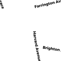
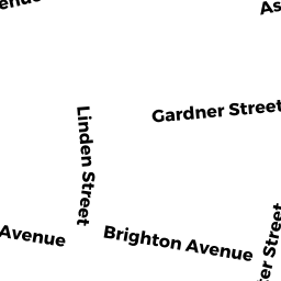
145155 BRIGHTON AV
Owner Information
SANIEOFF KHOSRO
PO BOX 830 #
BROOKLINE, MA 02446


Property Details
145155 BRIGHTON AV is classified as a Mixed Use (Primarily Commercial, some Residential) (Apt 7-30 units).
The primary structure on this property was built in 1910. There are 25314ft2 of built area within this property. There is 16876ft2 of residential/living space within this property.
145155 BRIGHTON AV is valued at 5078800. The land is valued at 1413800 and the structures are valued at 3665000.
The most recent deed for 145155 BRIGHTON AV is recorded at the local registrar in Book 19904, Page 245. 145155 BRIGHTON AV was last sold on 1995-07-27 for 1005015.
Assessment data from fiscal year 2020.
Flood Data
According to the FEMA National Flood Hazard Layer, this property does not appear to be in a flood zone. It may also be in an area not yet reviewed. Nonetheless, confirm this information prior to taking any action.
To view the flood hazards around this property, create a FEMA "Firmette" Map of the area around 145155 BRIGHTON AV.
Broadband Internet Providers
| Provider | Type | Bandwidth (mbps) | |
|---|---|---|---|
| Viasat Inc | Satellite | 100 | 3 |
| RCN | Cable | 1000 | 20 |
| Verizon New England Inc. | DSL | 15 | 1 |
| RCN | Cable | 500 | 20 |
| RCN | Cable | 25 | 4 |
| Comcast | Cable | 1000 | 35 |
| T-Mobile | Fixed Wireless | 25 | 3 |
| PAETEC Communications, Inc | DSL | 0 | 0 |
| netBlazr Inc | Fixed Wireless | 50 | 50 |
| Starry, Inc. | Fixed Wireless | 200 | 200 |
| Verizon New England Inc. | Fiber | 940 | 880 |
| VSAT Systems, LLC. | Satellite | 2 | 1 |
| HughesNet | Satellite | 25 | 3 |
| GCI Communication Corp. | Satellite | 0 | 0 |
Broadband service provider data from December 2020.
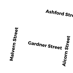
Adjacent Properties
- 9 Gardner ST
Other, Open Space owned by NINE GARDNER ST CONDO TRUST - 9 Gardner ST 5
Residential Condominium owned by WANG HANJUN - 9 Gardner ST PS 6
IMPUTED - Residential owned by ZHANG WEI - 9 Gardner ST 3
Residential Condominium owned by WANG GONGDA - 9 Gardner ST 1
Residential Condominium owned by LIU YUEYANG - 9 Gardner ST 4
Residential Condominium owned by XIE YUNZHE - 9 Gardner ST 6
Residential Condominium owned by CARDALINO KELLY A - 9 GARDNER ST 8
Residential Condominium owned by CHEN LUHAO - 9 Gardner ST 9
Residential Condominium owned by CANDELLA JARED - 9 Gardner ST 11
Residential Condominium owned by KWAN YU SANG - 9 Gardner ST 12
Residential Condominium owned by SU GUANGSHENG - 9 Gardner ST 13
Residential Condominium owned by GARG ANIL K - 9 Gardner ST 14
Residential Condominium owned by WU MENGYANG - 9 Gardner ST PS1
IMPUTED - Residential owned by KWAN YU SANG - 9 Gardner ST PS 3
IMPUTED - Residential owned by CANDELLA JARED - 9 Gardner ST PS 4
IMPUTED - Residential owned by WU MENGYANG - 9 Gardner ST PS 7
IMPUTED - Residential owned by CHEN LUHAO - 9 Gardner ST PS 9
IMPUTED - Residential owned by KWAN YU SANG - 9 Gardner ST PS 10
IMPUTED - Residential owned by CUBILLOS JUAN F - 9 Gardner ST PS 12
IMPUTED - Residential owned by SU GUANGSHENG - 9 Gardner ST PS 13
IMPUTED - Residential owned by GARG ANIL K - 9 Gardner ST PS 14
IMPUTED - Residential owned by NINE GARDNER STREET LLC - 9 Gardner ST PS2
IMPUTED - Residential owned by WANG GONGDA - 9 Gardner ST PS 11
IMPUTED - Residential owned by WANG HANJUN - 9 Gardner ST 2
Residential Condominium owned by ZHANG WEI - 9 Gardner ST 7
Residential Condominium owned by JERRY DONG REALTY TRUST - 9 Gardner ST 10
Residential Condominium owned by CUBILLOS JUAN F - 9 Gardner ST PS 5
IMPUTED - Residential owned by JERRY DONG REALTY TRUST - 139-143 BRIGHTON AV B
IMPUTED - Commercial owned by 139 -141 BRIGHTON LLC - 139-143 BRIGHTON AV A
IMPUTED - Commercial owned by 139 -141 BRIGHTON LLC - 139-143 BRIGHTON AV C
IMPUTED - Commercial owned by 141 BRIGHTON LLC - 139-143 BRIGHTON AV 2-R
Residential Condominium owned by 139-141 BRIGHTON AVENUE LLC - 139-143 BRIGHTON AV 3-L
Residential Condominium owned by 139-141 BRIGHTON AVENUE LLC - 139-143 BRIGHTON AV 3-R
Residential Condominium owned by 139-141 BRIGHTON AVENUE LLC - 139-143 BRIGHTON AV 2-L
Residential Condominium owned by 139-141 BRIGHTON AVENUE LLC - 139143 BRIGHTON AV
Other, Open Space owned by 139-143 BRIGHTON AV CONDO - 139-143 BRIGHTON AV D
IMPUTED - Commercial owned by 139 D BRIGHTON AV REALTY